Sunday, February 27, 2011

20th February 2011

It rained quite heavily and almost continually for the last two days and was quite windy, but today for the first time since we started our road trip the wind has become so strong that we have taken down our annex before the wind takes it down for us. We have experienced strong winds before but we were more sheltered in other areas by hills, fences or buildings, but here in Low heads near George Town we are very exposed on the east shore of the Tamar river estuary which allows the 40 knot wind to hit us head-on. When the wind changes direction it comes across an open field from the ocean behind us, as we are on a point so we don’t get any relieve from the change of direction.

21st January2011

Today the wind is not so severe but still cold and holding the temperature down to 20° despite the effort of the sun.

We drove down to West Launceston to the Penny Royal which is listed as a tourist attraction for some reason. It is a motel/restaurant and private apartment complex with a difference, in so much as it was disassembled from its original site with every stone numbered and rebuild at the side of the Gorge.

Each apartment has a different frontage with a castle gate entrance to the rear area. We moved the car down to the waterside by Royal Park and bought lunch at a fish & chip takeaway and then walked through the small park by which time the tide had come in sufficiently to cover the mudflats that appear at low tide.

We then drove out to Deloraine and on a further 10km along the Mole Creek road to a salmon farm called 41° South to buy some hot smoked salmon which Merry was introduced to by the people we chatted with at Evercreech Forest Reserve. We met another couple there that were looking for Montana Falls and helped them look for it after consulting the management at the salmon farm for directions. We never found them so returned to George Town via an alternate, shorter route via Exeter. We discovered that the Bell Bay Power station down the road from George Town has gas fired turbines with the natural gas being supplied by an underwater pipeline from Victoria and that there is also a DC power connecting cable from George Town to Victoria so that they can trade power when required. The system uses Earth as the return conductor just like using a car body as the return conductor, and the DC is changed to AC via invertors at up to 600Mw at a time. The actual power station was built as a back up to the Hydro system for times of drought and therefore, is hardly ever used.

22nd February 2011

We attempted to visit the Bell Bay harbour, which is supposedly the busiest harbour in Tasmania, but gates avoid anyone getting too close, so we moved on to Mt George lookout for an overview of the area.

On a clear day such as today it is possible to see the top of the suspension framework of Batman bridge, the head gear at Beaconsfield Gold Mine and the lighthouse on the end of the point. From there we moved on to look at the mural on the local water tower and then on to Bell Buoy Beach where the tide was well and truly in, and excluded any beach.

  •  24th February 2011

We had already put the annex and awning away because of the wind a few days ago and haven’t bothered to set them up again just for a few days, which made it very easy to do a final pack up today to head for Devonport where we are very close to the Ferry terminal as we have to be at the terminal at 6.30am on Monday. We can watch the Spirit of Tasmania come and go a few times whilst we are here.


The 13 month tour of Tasmania to all intents and purposes is over with a short drive around Devonport. We have missed a few small townships as it not possible to see, or do, everything but we have done enough to claim that we have genuinely seen Tasmania.

We have spent a week, but usually 2 weeks or more, at 21 of the recognised tourist places and used them as a base from which to tour the surrounding area within a 60km radius, which has covered almost all of the main roads, many minor roads and quite a few unsealed roads. We have:

 visited towns that are noted for their murals, their topiary or even their oddball letter boxes

 and visited others towns that are known for their fantastic pepper/steak pies or pancakes.

 visited 22 waterfalls (three of them twice)

 watched a blowhole perform

 visited at least six museums with the Zeehan Mining Museum being the best with Hobart a close second.

 watched powerboat racing and a surf lifesaving championships

 enjoyed a rack and pinion train trip

 been around when the world record number of water skiers behind one boat was achieved

 been down 3 caves (one of which has just been re-opened since it flooded)

 taken 5 boat trips, other than the ferry to Tassie and the ferry to Bruny Island.

 been to the Launceston Festivale and Carrick Agricultural Show

 been to the Echidna and Platypus park, the Tasmania Zoo, the Seahorse aquarium, the Beaconsfield mine

 explored the remains of old mining towns

 visited markets and sampled several local cheeses and wines

 driven along more roads with sheer drops off one side more times than you can shake a stick at.

 driven over numerous mountains because you have to

 seen most wildlife associated with Tassie

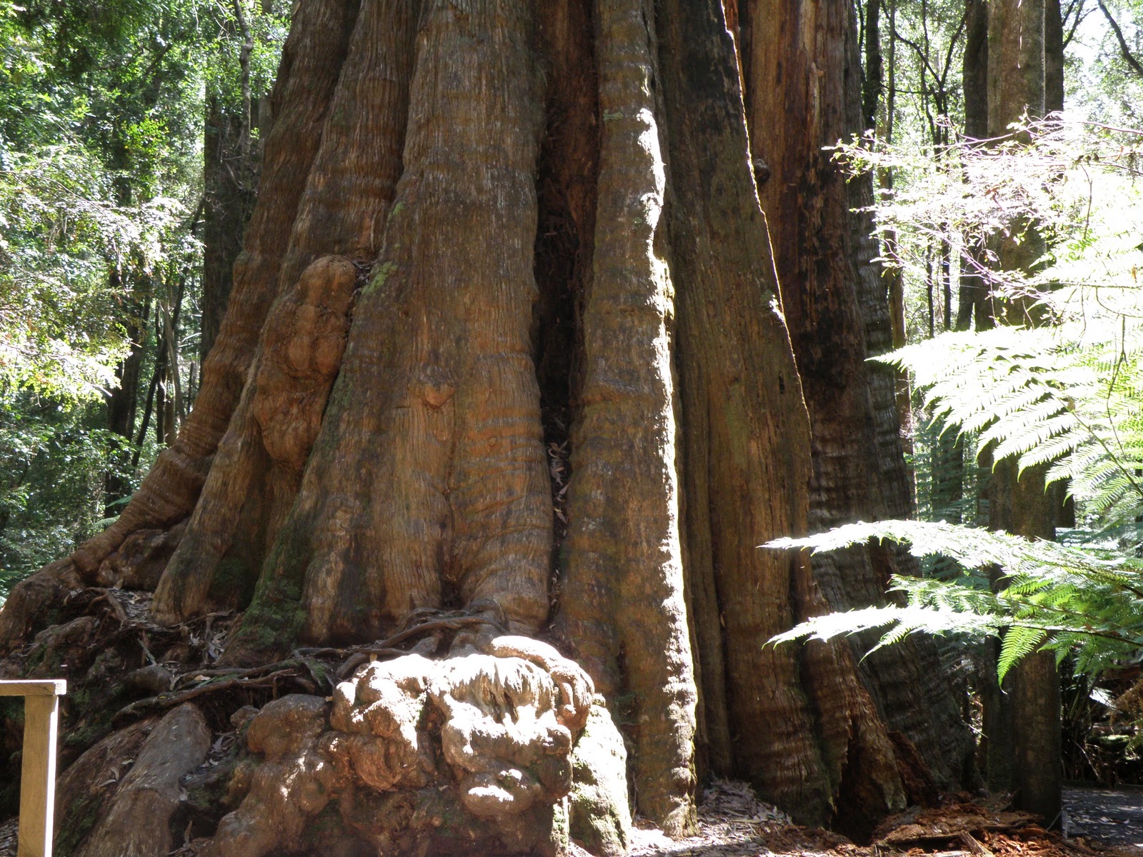
 walked for hours through rainforests

 climbed many lookouts for great views

 met many friendly people including some we knew in WA

 Best of all we had the bonus company of Stu and Be and their respective parents on several occasions.

The only thing we haven’t experienced is summer and genuine warm weather. Tasmania is a beautiful state but unfortunately going nowhere due to a pathetic local government that has been in power way too long, and they also have shocking narrow roads and woeful drivers.

26th February 2011

We drove through to the other side of Latrobe to the Cherry Shred bought some cherries which in fact were classified as seconds due to slight rain damage but were still better than the cherries in the supermarkets and only half the price. As it was nearly an acceptable lunch time we also submitted to a cherry pancake with cherry/chocolate ice cream which went down quite nicely. In the late afternoon we walked from the caravan park to Pardoe Beach, back to the Ferry Terminal and then back to the Park but that walk didn’t reveal anything special, just a 3.6km walk.

27th February 2011

We did our final preparation in readiness for our move to the Ferry Terminal at the crack of dawn tomorrow morning.


Friday, February 18, 2011

9th February to 16th February 2011

9th February 2011

Once again we packed the annex in readiness for our move tomorrow rather than taking the risk of leaving it until the morning as the weather report indicates the possibility of rain, and also the next stage is slightly longer than we usually do. We also anticipated a long slow haul up the mountain to Derby.

10th February 2011

With the majority of the packing up already done we were able to leave quite early. We were also fortunate on the uphill stretch into Derby as we had nobody pestering to pass us in an area where passing is not a great idea. We made it to the top alright but on the descent on the other side we did have one cowboy logging truck driver who thought he had the right to use our side of the road to get round a really tight bend. However, we didn’t give in to him and didn’t move over as there was only straight down on our side, which forced him to wind his neck in and move over, with just enough clearance. We arrived in Low Heads, which is a short distance from Tasmanias first settlement George Town, earlier than expected which was good as it allowed us to put up the annex before the threat of rain became a reality, which it did about 5 minutes after we were completely set up.

11th February 2011

Barry took the car into Launceston to have the annual service on the gas fumigation system and pickup a new lid for the washing machine that we ordered a few months ago.

12th February 2011

We drove back towards Bridport and turned off to visit the Lavender farm which is supposedly the only perfume grade lavender farm in the southern hemisphere, and in the world.

However, we were aware that we were visiting at the wrong time of the year as the harvesting is done in January, so we didn’t get to see the purple crop in bloom covering the fields as far as the eye can see, but we can say we have been there, and did get the general idea.


We continued on to the Lilydale Falls which is actually 2 falls about a 5 minute walk apart and the first fall is only 5 minutes from the carpark. Neither fall is especially high, were they raging torrents as the north east hasn’t had as much rain as other areas, but both had their charm.


After the mandatory lunch in the carpark we drove on to Holybank Treetop Adventure Park where you are suspended in a harness and travel around the treetops on an overhead cable for an hour, or more. We called in for information only as we do not want to book and then do it in the rain, as there are no refunds and once you have booked you are committed. One major drawback is the $90 each price tag for pensioners. The other drawback is the fact that you can’t take cameras with you, or anything else for that matter, as any dropped item can seriously affect anyone walking in the park below. We understand that, but it is a bit pointless without the lasting memories afterwards, and Merry could not go that long without a drink of water which we would not be able to carry with us, so that puts an end to that idea . We have done 3 different treetop walks at various places so we don’t feel we are missing too much.

On the return journey home we did the usual thing and took a slight detour to the Batman Bridge as a recognisance trip to ensure we can use this bridge and road for our next move to Devonport. The bridge is quite impressive at 313 feet high and as many metres long over the Tamar river and will provide a much shorter route than going down to Launceston to cross the river.


13th February2011

We have discovered that there isn’t much to see or do around George Town so spent today preparing meals, and loading necessary equipment from the van to the car, in readiness to drive across to Arthur River to spend a few days camping in our tent. This allowed us to visit the wilderness area in the top left hand corner of the state and effectively ensure that we visited every area of Tasmania in the year that we have been here.

14th February 2011

We headed east on our intended journey through a lot of the area that we have previously covered last year but just before reaching Stanley we turned inland to check out Dip Falls.

These falls drop in two stages over basalt columns and have a track to the base including 160 steps and once there over a great view of the lower fall with a small amount of the top fall showing which belies the true height as the top fall is the highest of the two stages.

This becomes evident when you return to the top and walk over the bridge and around to the viewing platform on the other side of the river. Both drops have their different appeal and are very different to the other falls we have visited.


We drove on over the bridge to the Tall Tree, another one, but different breed, but is mainly interesting as the base apparently is thick enough to require 15 men to join hands to reach round it rather than the height. We then continued our journey past Smithton and on to Arthur River but again detoured briefly into Dismal Swamp, now renamed Tarkine Forest Reserve which boasts a tubular slide down into the rainforest in a sinkhole. You sit on a mat with your feet in a hooded nose cone and slide extremely quickly through the tube to the forest floor. The nose cone stops you using your feet to slow down which you would probably try to do on the steep bits. We watched from the viewing platform for a moment’s amusement as people raced through the tube before heading off to our final destination at Thorny Wattle campground, just south of the township.  We had this to ourselves for the duration of our stay at a cost of $6 a night and had a water supply that was not suitable for drinking, but fine for washing, and a not-so-nice deep drop toilet, but we had 76 litres of drinking water with us, and our own toilet.

15th February 2011

We went into town (using that term very loosely) and stopped by the jetty were the two river cruise boats operate from to check out what they offered and explained that we had the dog with us and would therefore not be going on the trip. Within minutes they had organised a dog sitter and would wait for us to drop Foxy off, and we were on our way. The trip took about 4 hours and included morning tea and afternoon BBQ lunch.

We watched some White Bellied Sea Eagles swoop to catch food that was thrown out for them and saw their huge nest as we cruised by. During the lunch break we had a forest walk with a very informative commentary during which we discovered that the Tasmanian Eucalyptus trees (Gum trees) are more commonly called Tasmanian Oak as people prefer that name for their furniture and kitchen cupboard doors. They grow quickest and tallest in the rainforest after a bush fire and provide a covering canopy for the Myrtle, Sassafras, Leatherwood, Blackwood and Man ferns (Tree ferns everywhere else) and when the Myrtle is old enough (around 350 years old) it puts out a toxic poison that kills off the Eucalypts as they are no longer needed for their survival, and is the reason you see what looks like dieback trees (called stag horns in Tassie) sticking up out of the forest. We also now know that the Sassafras is the first to flower at the beginning of summer and the Leatherwood is the last to flower at the end of summer. On the return trip we watched a large Tiger snake swimming across the river and gradually slowing down as the cold water sucked the heat out its body, but it did make it to the other side.

After the boat trip we collected Foxy, which took a while as the couple wanted to chat for ages and used a baby wombat as an added attraction (she is a wild life carer for little orphans) and eventually took a walk along the river estuary to the ocean to get back on friendly terms with Foxy after she gave us a telling off for leaving her. We then drove to Smithton via Marrawah to make sure the secondary battery in the car was charged well enough to run the Engel fridge/freezer through the night, and to check out the town, which was much larger than we expected.

16th February 2011

We packed up the camp as we were going to check out some other attractions further into the Tarkine wilderness with a possible overnight camp somewhere else. We drove south along a gravel road to Couta Rocks and then east to Kanunnah Bridge which is supposed to offer views of the Frankland River (not the Franklin River) rapids when there is sufficient water flowing, and into the South Arthur Forest.


Here we visited the Sumac Lookout (which provides excellent insight to the dense forest of the Tarkine region), the Julius River rainforest walks where we had lunch, another lookout over button grass, which is 80% of the cause of the brown tannin in the rivers  rather than the trees, and Lake Chisholm which is a huge sink hole that has filled with water due to the base being sealed off with dead foliage and clay.

There are no inlets or outlets but it is always full. We had intended to continue on to Milkshakes Hill Reserve to do the rainforest walks but the Tayetea Bridge was washed out by floods in 2007 and hasn’t been repaired since (things happen slowly in Tassie) so we had to give that idea away and consequently, having seen most of the points of interest in the area, determined that there was enough time to drive home rather than camp out for another night, especially as the weather appeared to be closing in. We continued the journey mainly on gravel roads through the bush, rather than backtracking to Arthur River and out through Smithton, as it cuts off a huge triangular route, and emerged east of Stanley on the Dip Falls road. We stopped off at Wynyard for another cuppa, and a rest from the hours of driving, and ultimately arrived back at the caravan in time to watch the 7.00pm news.

Tuesday, February 8, 2011

25th January to 7th February 2011

25th January 2011

Day of rest after the trek around Freycinet but in the afternoon we manage a walk along Denison beach as our literature vaguely mentioned something of significance in that area but we didn’t find anything other than the usual sand and sea that one finds at the beach.

26th January 2011

Australia day and a fine weather one at that. We drove to St Marys via Elephant Pass but resisted the pancakes but turned off to South Sisters Lookout which took us uphill along a dirt road for quite a while until we found the turn off to the lookout and then became more suited to 4WD vehicles, but still going uphill, but more steeply. We eventually came to a carpark just below a shed which presumably was something to do with the antennas on the lookout. We walked the remaining part of the road to another parking area outside the shed which offered a lousy lookout situation but we found a narrow track hidden by bracken and then noticed the stony, stepped track with a handrail. The track was steep with uneven height rock steps and was tough going and split near the top to go to two separate antennas which meant climbing to each in turn. The views from the left hand antenna platform were great but restrict in direction whereas the second platform allowed 360 degree views. Climbing down was just as hard as climbing up, with some parts requiring Foxy to be lifted as the jump was too great for her little legs. On the way back down the road from the carpark we met a young couple walking up the road as their car was not suitable. We informed them that they still had half a kilometre to go and then the climb to the top, so they gave it away and came back down to their car, with us. We met another older couple doing the same thing but they decided to push on, but our money says they gave up long before they got to the top. We continued on to very small village of Fingal where we sat in the local park and had our lunch, and notice a silvery stripe amongst the trees in the distance and guessed that it was the Mathinna Falls, which is where we were heading.

 Our guess turned out to be correct but the track took us to the base of the falls which only allowed aview of the last fall with a glimpse of more above it. On the walk in we had a view of the top of the falls which was very high so we knew there was a lot more than could see from the bottom, but when we attempted the very steep, very rough track upward it proved too severe for us oldies.


We met other people who claimed to have climbed up to the next level but they were much younger than us. From here we backtracked on the dirt road to the turn off to Evercreech Forest Reserve that claims to have the world’s tallest White Gum Trees (90 metres tall). From the carpark it is a 10 minute return walk to the Tall Tree observation point, or continue on for a 20 minute circuit walk. There is also a 40 minute circuit walk that takes in Evercreech Falls which we didn’t know about as the falls doesn’t get a mention in any of the literature we have gathered, nor is it mentioned on our map. We did the 20 minute walk first which ended at a second carpark where we met the people that had climbed the second part of Mathinna Falls who also informed us that doing the 40 minute walk involved crossing the river on stepping stones with a rope support. We changed from our shoes to our walking boots and attacked the 40 minute walk which actually took us about 55 minutes.


The crossing didn’t get our feet wet thanks to the walking boots, but we suspect the stepping stones only had water over the top of them due to the excessive rain a couple of weeks ago, which also means we are probably seeing these waterfalls at their best.


We returned to the main bitumen track via another alternate dirt road which we estimate cut off up to 20 kilometres, and then headed for home but with the intention of a short detour to the coal mining village of Cornwall to view the Coalminer’s Heritage Wall. A nice tribute to the past miners but not a ‘must see’ tourist attraction so used the stop as an excuse for a tea break before so heading home.
27th January 2011

Once again we packed up the camp and moved on northwards to St Helens. The most significant observation on the way was that the road gets narrower as you head north. It is the most used road in Tasmania by the tourist trade so it carries numerous caravans, motor homes and as with most of Tassie, logging trucks, which all only just manage to pass each other so long as you run your nearside wheels on the very edge of the bitumen whilst you hold your breath. We needed to do some shopping, and had been looking forward to St Helens as it boasts a super IGA store, but were disappointed with it as several items we wanted weren’t stocked.

28th January 2011

We drove into town for more information from the visitors centre and gained a copy of a map that we already had and rough idea of where dogs are allowed, or not. They only had one copy of the 4 page document and a broken copier so you had to memorise it all.

We went on our way towards the Bay of Fires but deviated to Binalong Bay and Humburg Point first, which gave us views across the bay with several small, genuinely white beaches separated by rocky outcrops covered with red lichen, plus views of a lagoon. We proceeded to The Gardens at the end of the road running past the Bay of Fires and stopping off at some of the parking areas to check the beach. This was a huge disappointment for us as literature we had read in the past had built up ideas in our minds of a beach littered with rocky outcrops, or boulders, covered in red lichen creating the effect of fires. In reality it is a beach littered with sand, albeit a nice white coating of sand, but not exactly what we were expecting.  At the very end of the road at The Gardens is a rocky outcrop and prior to Bay of Fires are a few rocky outcrops, but not on the Bay of Fires, just sand. Rather like Hellfire Bay near Esperance in WA where there is no Hell and no fire, just peace and tranquillity.

 A few of the other stopping points on the way back after the Bay offered some views of lichen covered rocky outcrops to console us. So far we preferred Bicheno for its lichen covered rocks, the blowhole within the rocks, granite lookout outcrops that you can climb and only a 5 minute walk into town, whereas here we have a 5 minute drive into town.


29th January2011

In the afternoon we drove down to Scamander to check out the claim to having some of the best coastline in Tasmania. If you are a beach type person then the claim could be correct as l there is only a long sandy beach, but not as white as the Bay of Fires beach. It was also not suitable for little kids as the wave break was very high and strong, but that may have just been one of those days. What we consider to be great coast line is what we saw around Bruny Island, Freycinet Peninsular and the Great Ocean Coast road.

30th January 2011

Since arriving in St Helens we have had very windy afternoons and also last night but it has calmed down since day break and produced a humid day with a summer-like temperature.

1st February 2011

It rained most of yesterday, and today is back to windy with the rain expected in the evening.

In the afternoon we took a short walk in the memorial parks (1 for fishermen and 1 for soldiers) and along the harbour front and then drove out to Burns Bay on the end of the Point. Here we took the 60 minute return walk to Beerbarrel Beach via St Helens Point. This provided some good views of lichen covered rocky outcrops and an echidna on the return journey.


 Merry took a 10minute walk to St Helens Light for an elevated view of the surrounds before we returned to camp just in time to beat the rain.


A not so perfect panorama.
We have decided to return to Mainland Aussie earlier than we had booked for in May and have re-arranged our return trip for the 28th February.

3rd January 2011

We drove out to Pyengana and on to St Columba Falls (the highest Tasmanian falls) which we have declared to be the best so far, marginally better than Nelsons Falls.

The top half of the falls is highly visible from the carpark and wonder if it is worth the 10 minute walk from the carpark to the lookout at the base of the falls. The walk alone is worth it in its own right as it is all temperate rainforest fern trees, some of which have grown with other trees growing through them. The lookout platform allows great viewing over multiple cascades as the water splits in several directions on the way down in varying length drops.


 On the way back towards Pyengana we turned at the appropriate signpost onto the dirt road to Ralph Falls but came to a T junction with no signpost and took the straight on option which turned out to be the wrong one, but it covered some interesting areas. We eventually came across a couple of logging types and one of them gave us directions to the falls via Ringarooma, rather than backtrack. We estimate that the trip was about 50kms from T junction to the Falls when we arrived there, but had given us some great views as we approached Ringarooma.


We had lunch in the carpark and then did the 10 minute walk to the lookout (Norm’s Lookout) which looks across a 90 metres deep void straight into the ribbon of water at the top of the falls. It is a narrow ribbon of water that falls in a single drop and Australia's tallest single drop falls.


On the return track we took the optional 40 minute circuit walk to Cash’s gorge which offered a couple of lookouts, one of which was simple a case of perch yourself on the rock cliff edge, but did have a view of another small no-name waterfall, and the other is a fenced platform at a point that was safe to stand at without the barrier.


The track then became a boardwalk along what was originally the Ringarooma 1884 bridle path back to the carpark. The car trip out in the other direction brought us back to the T junction where we originally went wrong and was only about 5kms.

The intention now was to head back towards Pyengana and turn off to Halls Falls but decided to give it a miss and return for that waterfall another day. We took a quick detour to photo the Pub in the Paddock, an out-of-the-way excuse for a gargle if you so desire, and then stopped off at the Holy Cow Cafe near Pyengana for a coffee and cake. This is cheese factory/cafe where you can see the cows being milked as well as tasting the variety of cheeses.

4th January 2011

The weather is threatening rain but this didn’t happen until late morning but convinced us to stay put but had the pleasant knowledge that Stuart and Belinda would be on their way to join us in St Helens when Be leaves work at 4.30pm. We met them soon after their arrival after a 250km journey and had dinner in a waterfront restaurant.

5th January 2011

Stu and Be picked us up in the morning for breakfast in town which was an excellent decision and included a long chat time. We then headed out to St Columba Falls as the 10 minute walk from the car park allows wheelchair access which is fine on the downhill way in, but not so good coming back out. It is amazing just what Be can manage as Stu is no light weight but she is, although she did get some assistance from us on the steeper inclines, but she got a good work out without the help of a Gym.

We took more photos and on comparison with the previous photos there is slightly more water falling today. On the return journey we stopped again at the Holy Cow Cafe for cheese tasting and light lunch. We discovered that the dairy is robotic and each cow has an identity disc to operate the gate to come to be milk when she wants, but if she returns within 6 hours she is redirected back out without the milking. After they are automatically milked they emerge into an area that has a rotary backscratcher brush which the cows obviously love, and can’t get enough of it before heading to the paddock.  They are really contented cows and apparently produce more and better quality milk, which ultimately makes for better cheese.


6th January 2011

We had breakfast in town with Stu and Be and once again sat and enjoyed each others’ company for a while before they had to make their departure for the trip back Hobart, fortunately via Ross in order to pick up some of the Bakery’s magical offerings. This will be the last time we see them for a long time, probably until we all arrive back in WA in several years time which will take a while to get used to.

Rather than spend a lonely afternoon in the caravan we bought some fruit in town and drove out towards St Columba Falls again but turned off to Halls Falls and spent about 2 hours doing the return walk/climb to the falls and also a weir further upstream.

 We were going to make a cuppa when we got back to the carpark but that coincided with the arrival of three families with multiple kids and uncontrolled dogs. One of the dogs fancied Foxy for lunch but didn’t achieve it, and Barry read the riot act about dogs being on a leash in public, and especially in State Forests. When asked which dog did the attacking he said it was the grey one with the sore rib cage.

We moved on to Anchor Stamper to the old tin mining area to view the old water driven Stamper that was used to crush the ore, and is now being taken over by nature as the bush grows back. It presents a very different temperate rainforest picture with machinery intermingled with Fern trees. We then continued onward and upward into the Blue Tiers Reserve which is part of Mt Poimena where we finally had our cuppa before doing the Goblin Forest short walk as the other walks where way to long and too late in the day. We returned along the shorter route via Lottah back to the highway and home.

7th February 2011

Our time in St Helens is running short with still more to do so drove to the tin mining town of Derby and visited the Mining Museum. The mine had used a dam to collect water to operate the nozzle dud to wash the ore down and also other equipment, but during an unusually heavy period of rain the dam collapsed, flooding the mine with the loss of 14 lives. We drove on to Branxholm where we had our lunch in the local park, then continued to Legerwood where their local park is much nicer, and has nine memorial trees that became unsafe and cut down. The stumps now have chainsaw carved figures of the seven lost soldiers from the locality, and two depicting Gallipoli and the Anzacs.

We returned towards Derby  taking the Derby Back Road which bypasses the town, and then turned off towards Gladstone to visit the Little Blue Lake, which is a disused quarry filled with water that has turned a Turquoise colour due to the decomposing granite.


We then continued on to Bridport to look it over as we can’t stay there due to the only caravan park not accepting dogs. However, it doesn’t matter as it didn’t have much to offer us, despite having met people who have said they would love to settle there.

We did get to see a ferry from Flinders Island, full of cattle, come into the narrow channel to the port. On the way to Bridport we did a short detour to a beach side Links golf course rated 33 in the world by an American golf magazine, which at the time was enduring high winds and would not be fun to play in, as several people coming off the course confirmed. We returned to Derby via Scottsdale and back to St Helens over the mandatory mountain that we will have to drag the caravan in a few days time.